Amangiri Resort: A Luxurious Oasis in the Heart of Utah’s Desert Nestled amidst the dramatic canyons and...
Amangiri location details
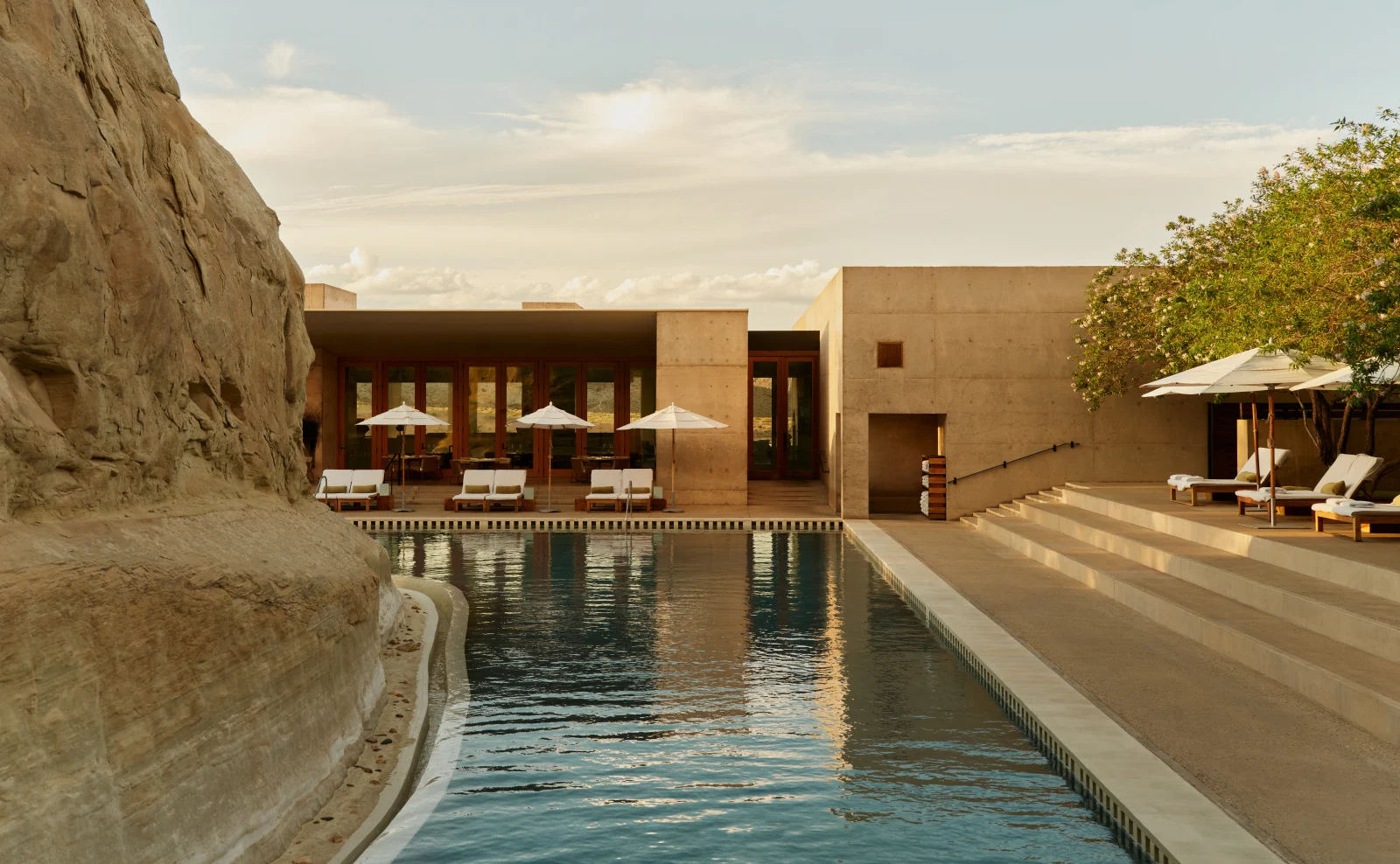
Amangiri’s location is perhaps its most defining characteristic, more than just an address; it’s a carefully chosen nexus within one of North America’s most geologically significant and visually spectacular regions.1 Here are the detailed location specifics:
Precise Address and Geographic Coordinates:
- Address: 1 Kayenta Road, Canyon Point, Utah 84741-0285, United States2
- Geographic Coordinates: Approximately 37.015507° N Latitude, -111.611277° W Longitude.3 These coordinates place it precisely in the heart of the high desert, allowing for pinpoint accuracy for navigation.
Elevation:
- Amangiri sits at an estimated elevation of 4,066 feet (approximately 1,239 meters) above sea level. This elevation contributes to the region’s arid conditions, clear air, and distinct seasonal temperatures, making the high desert experience even more pronounced.
Geological Context and Surrounding Features:
Amangiri is located within the Colorado Plateau, a vast physiographic province that is a geological wonderland. The resort’s architecture is meticulously designed to blend with, rather than intrude upon, this ancient landscape.4 Key geological features defining its surroundings include:
- Sandstone Formations: The dominant feature is the vibrant red, pink, and ochre sandstone, sculpted over millions of years by wind and water erosion.5 These formations manifest as:
- Mesa and Buttes: Flat-topped, steep-sided hills and mountains that are iconic to the Southwest, providing dramatic backdrops and panoramic views.6
- Canyons: Deep, winding gorges, including numerous slot canyons, formed by flash floods and erosion, revealing layers of geological history.7
- Hoodoos: Tall, thin spires of rock that protrude from the bottom of arid basins or badlands, often formed from differential erosion.8
- Slickrock: Smooth, undulating expanses of sandstone that offer unique hiking terrain.
- Ancient History: The rock formations themselves tell a story spanning over 180 million years of geological history, with traces of human life, including petroglyphs, dating back more than 10,000 years. The resort itself was built on land that once revealed numerous artifacts from prehistoric and Native American tribes.9
- Water Elements (Paradoxical Presence): Despite being a desert, the region is characterized by the profound influence of water.
- Lake Powell: A massive, man-made reservoir on the Colorado River, created by the Glen Canyon Dam.10 Its deep blue waters contrast starkly with the red rock, forming intricate shorelines and inviting exploration.
- Colorado River: The mighty river, which flows through the Grand Canyon, is a vital lifeline in the region and offers opportunities for serene float trips.
- Desert Ecology: The arid conditions support a unique high desert ecosystem, with hardy plant life (like various cacti, sagebrush, and desert grasses) and resilient wildlife adapted to the environment.
Proximity to National Parks and Tribal Lands (The Grand Circle):
Amangiri’s strategic location within the “Grand Circle” is one of its greatest assets, offering unparalleled access to some of America’s most iconic natural and cultural treasures:
- Grand Staircase-Escalante National Monument: The resort is directly surrounded by and blends into this vast monument, providing direct access to its wilderness.11
- Navajo Nation: Amangiri is located very close to the Navajo Nation, the largest Native American reservation in the United States.12 This proximity allows for unique cultural tours and interactions, such as Navajo-guided trips to Antelope Canyon and Monument Valley.13
- National Parks within a Few Hours’ Drive:
- Lake Powell: (Very close, short drive)14
- Grand Canyon National Park (North Rim): Approximately 2-3 hours drive.
- Zion National Park: Approximately 2-2.5 hours drive.
- Bryce Canyon National Park: Approximately 2.5-3 hours drive.
- Monument Valley Navajo Tribal Park: Approximately 2.5-3 hours drive.
Nearest Airport and Access:
- Primary Access Airport: Page Municipal Airport (PGA) in Page, Arizona.15
- Distance: Approximately 10 miles (16 kilometers) southeast of Amangiri.
- Drive Time: A short and convenient 25-30 minute drive.
- Transfers: Amangiri provides complimentary airport transfers to and from PGA.
- Flights: PGA handles commercial flights connecting from larger hubs (like Phoenix Sky Harbor International Airport – PHX) and is also a popular destination for private charter flights.
- Resort Helipad: Amangiri has its own private heliport (FAA Identifier: UT18) on-site at an estimated elevation of 4,066 ft.16 This allows for direct helicopter transfers for guests arriving via this method, bypassing PGA and ground transfers if desired.
- Major Commercial Airports and Drive Times:
- Las Vegas (LAS), Nevada: ~4 to 4.5 hours drive (approx. 270 miles / 435 km).
- Phoenix (PHX), Arizona: ~4 to 4.5 hours drive (approx. 270 miles / 435 km).
- Salt Lake City (SLC), Utah: ~6 to 7 hours drive (approx. 380 miles / 610 km).
- St. George (SGU), Utah: ~2.5 hours drive (approx. 150 miles / 240 km).
The journey to Amangiri is deliberately designed to enhance the sense of seclusion and transition from the outside world into this extraordinary desert sanctuary. The winding road descending into the valley where the resort is subtly carved into the landscape reinforces the feeling of discovering a hidden gem.